Remote Sensing Ecological Index (RSEI)
A web-based scientific platform for ecological environment assessment using satellite imagery from Landsat, Sentinel, and MODIS missions. Integrating vegetation, soil, wetness, and temperature indicators, RSEI provides a comprehensive measure of ecological quality.
Get Started
Scientific Basis of RSEI
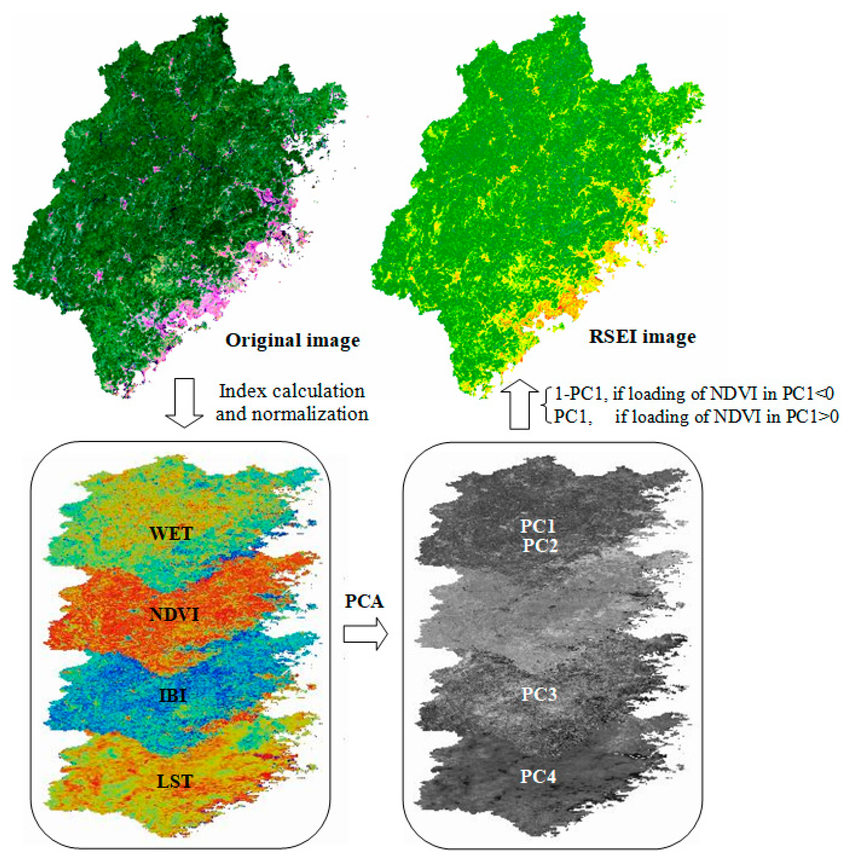
The Remote Sensing Ecological Index synthesizes multiple environmental indicators into a single metric of ecological health:
- NDVI – Vegetation greenness and biomass
- SI – Soil exposure and dryness index
- IBI – Built-up land and impervious surface index
- NDBSI – Normalized difference bare soil index
- WET – Tasseled Cap Wetness (humidity and moisture)
- LST – Land Surface Temperature
These indices are normalized and integrated using Principal Component Analysis (PCA) to generate a robust, quantitative measure of ecological quality ranging from 0 (poor) to 1 (excellent).
Application Features
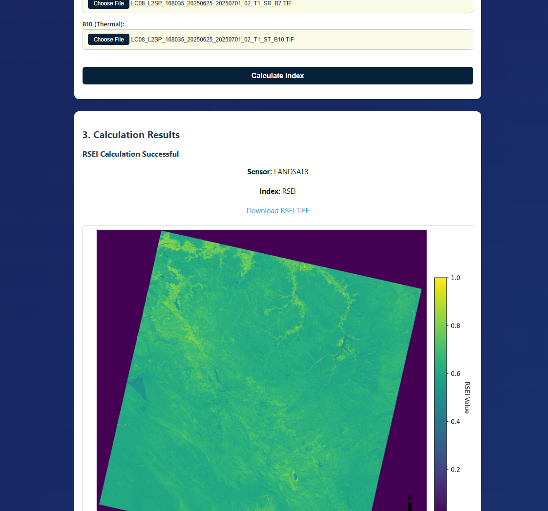
- Multi-band Processing: Upload and stack satellite TIFF files from various sensors
- Automatic Calculations: Compute NDVI, SI, IBI, NDBSI, WET, and LST indices
- RSEI Generation: Create PCA-based ecological quality maps with multiple export formats
- Data Preprocessing: Perform cropping, mosaicking, and reprojection operations
- Comprehensive Reports: Access detailed PCA reports with eigenvalues and eigenvectors
- Multi-sensor Support: Compatible with Landsat 3–8, Sentinel‑2A, and MODIS data
The platform provides an intuitive interface for researchers and practitioners to conduct comprehensive ecological assessments with scientific rigor.
Applications in Research and Practice
RSEI has been widely applied in environmental monitoring, urban studies, and sustainable land management across diverse ecosystems:
- Urban Ecology: Assessment of ecological quality and heat island effects in metropolitan areas
- Land Degradation: Monitoring desertification and soil erosion processes
- Climate Studies: Analysis of vegetation dynamics and climate change impacts
- Water Resources: Wetland conservation and watershed management
- Conservation Planning: Protected area monitoring and biodiversity assessment
- Policy Support: Environmental impact assessment and sustainable development planning
Reference: Arsalan A., Osman O. (2025). A remote sensing index for ecological evaluation. International Journal of Remote Sensing, doi.